
My earlier post Micronesia part 1: secluded stones mainly discussed high island landscapes related to volcanic rocks and megalithic cultural sites. This upcoming part 2 will focus on low island features derived from coral reefs. Not having read part 1 won’t affect understanding this post.
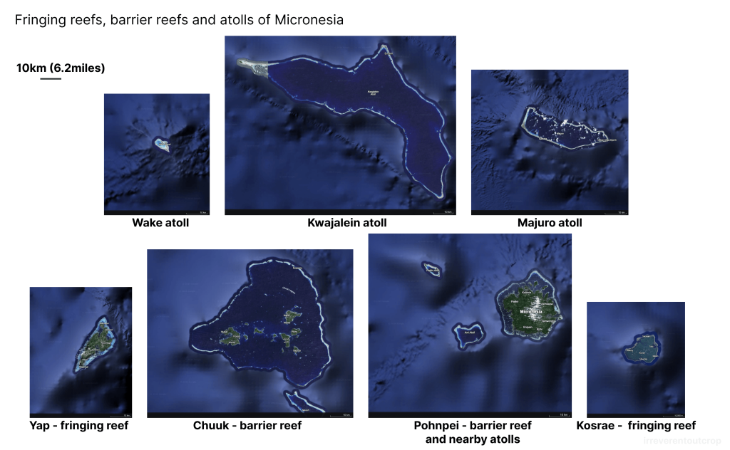
Calcareous skeletons of corals form limestone, which falls into the category of biochemical sedimentary rocks. Coral reefs are generally grouped into three types based on their morphology: fringing reefs, barrier reefs, and atolls.
- Fringing reefs are close to the shore without a distinct lagoon area behind them.
- Barrier reefs have deeper lagoons separating the reef crest and the coastline.
- Atolls surround a central volcanic island that has completely sunk.
It is generally believed that fringing reefs represent the initial stage of coral reef development. As sea levels rise or land subsides, coral reefs gradually move away from the shore and form barrier reefs. Eventually, as the volcanic island completely sinks, coral reefs continue to grow upward, and only the outer ring of the lagoon emerges above the water surface, forming an atoll, which represents the final stage. Islands without volcano tips are called “low islands”, contrasting with “high islands.” They have low terrain, poor soil, and typically only mangroves and coconut trees can grow on them.
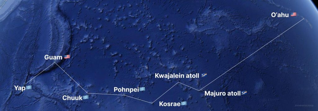
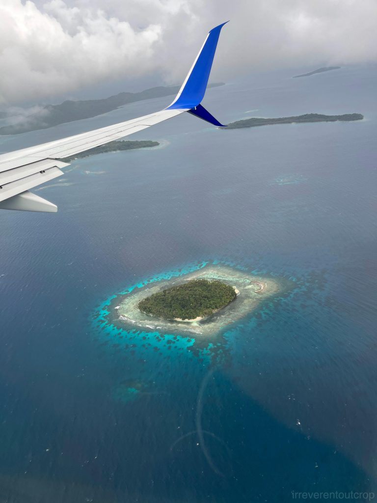
Our trip to Micronesia offers a view of all three types of coral reefs. I placed the same-scale satellite images of this journey’s seven main locations in the illustration below. It’s more intuitive and straightforward to compare their sizes and coral reef morphology this way. The satellite images also indicate parts of the seabed underwater, showing that all islands are built on underwater uplifts, with noticeable subsidence of the outer edges of the coral reefs (fore reef).
Marshall Islands
United Airlines flight UA154 departed from Honolulu and made two stops in the Marshall Islands—Majuro Atoll and Kwajalein Atoll, both of which are low islands—before entering the Federated States of Micronesia.
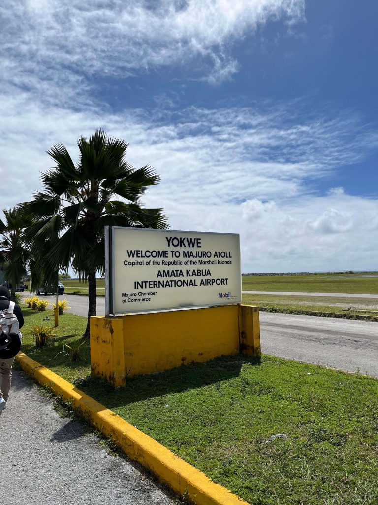
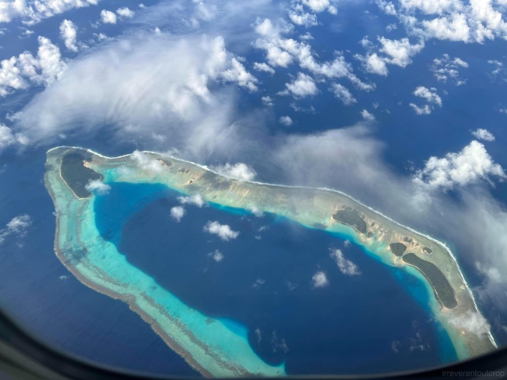
Majuro Atoll
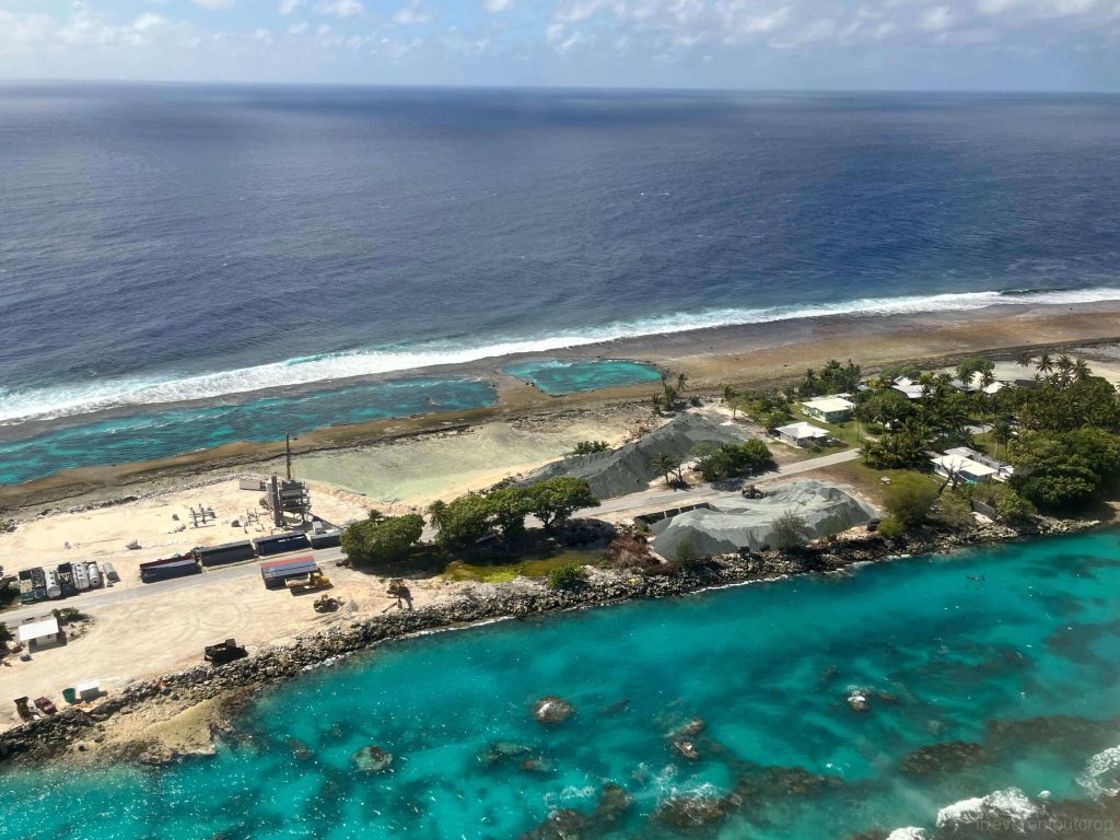
Majuro Atoll is the capital this country. It winds around in a long loop, but the total land area is only 10 km2/ 4 mi2, roughly the size of three Central Parks (NYC) and it’s accommodating a crowded population of 23k. Except for slightly wider ends on the east and west, most parts of the atoll are only as wide as a single road.
It’s said that almost everyone on the island bought old cars during COVID, and the traffic ended up terrible since there is only one road for most of the atoll. Their transportation problem could have been solved just by establishing one frequent bus line that circles around that one road?
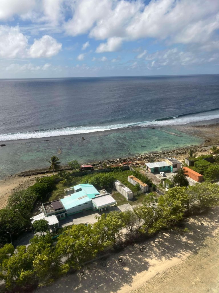
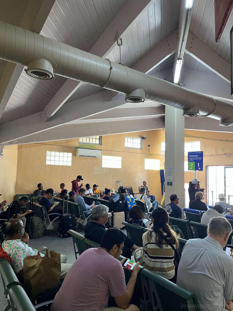
After the plane landed at Majuro Airport, transit passengers like us could get off the plane and stretch our legs in the terminal’s boarding area, but we wouldn’t have time to clear customs and then come back on. The boarding area is just a tiny, basic room, and it is quite crowded.
After a brief stopover, the plane took off again. I saw the southeast corner of the atoll during takeoff- the most densely populated part of the atoll. Many large boats anchored in the lagoon.
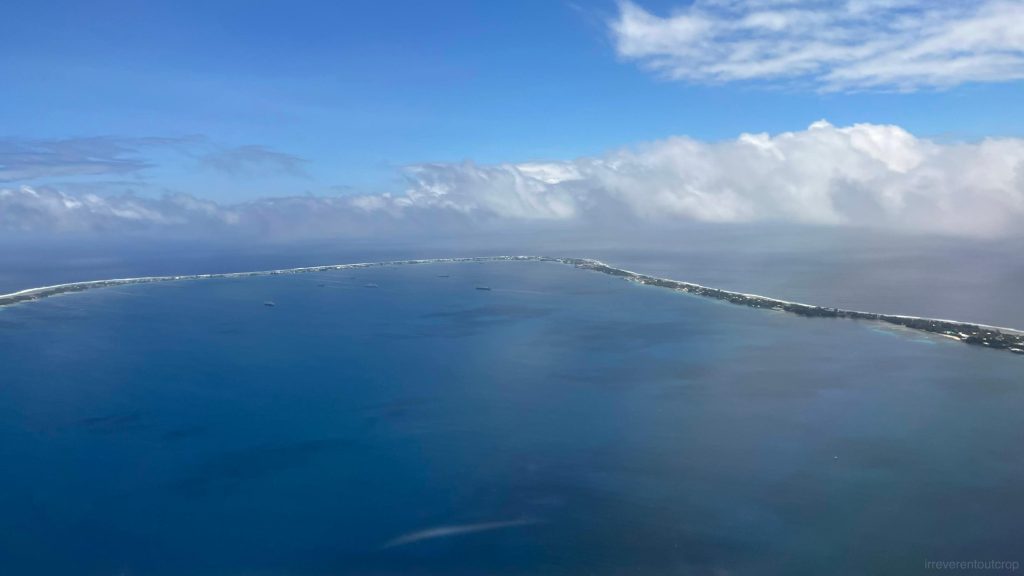
The plane soon flew out the atoll from the northern section. This stretch of sandbars is uninhabited with no infrastructure- just exposed reef crest and resilient mangroves.
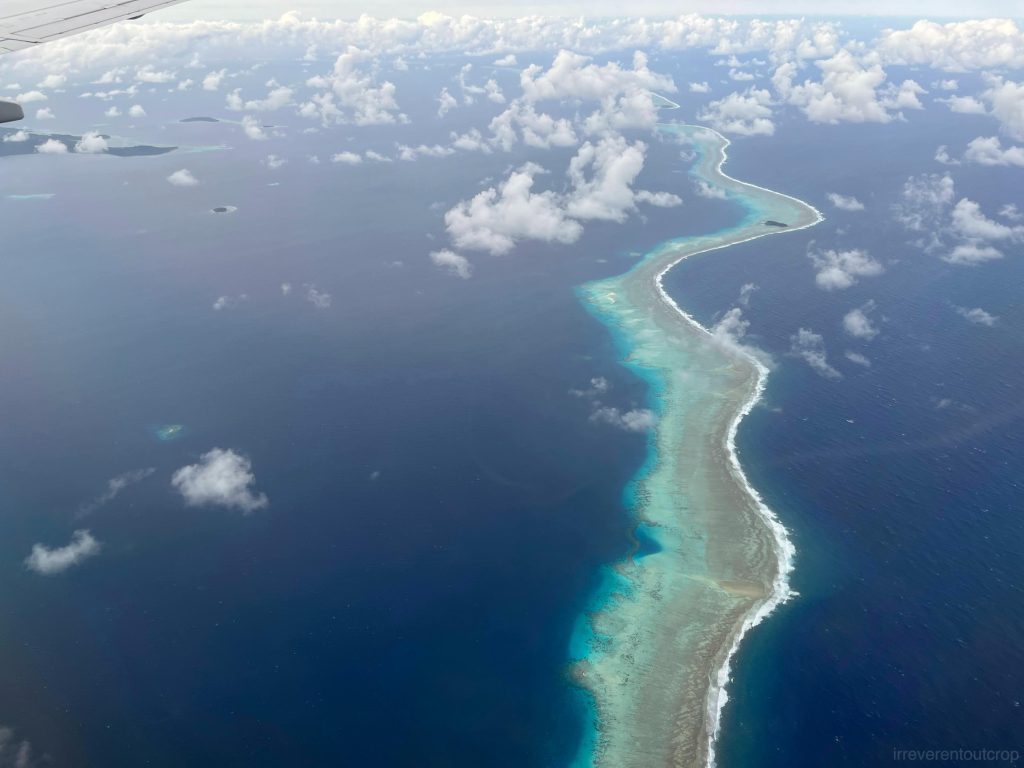
Kwajalein Atoll
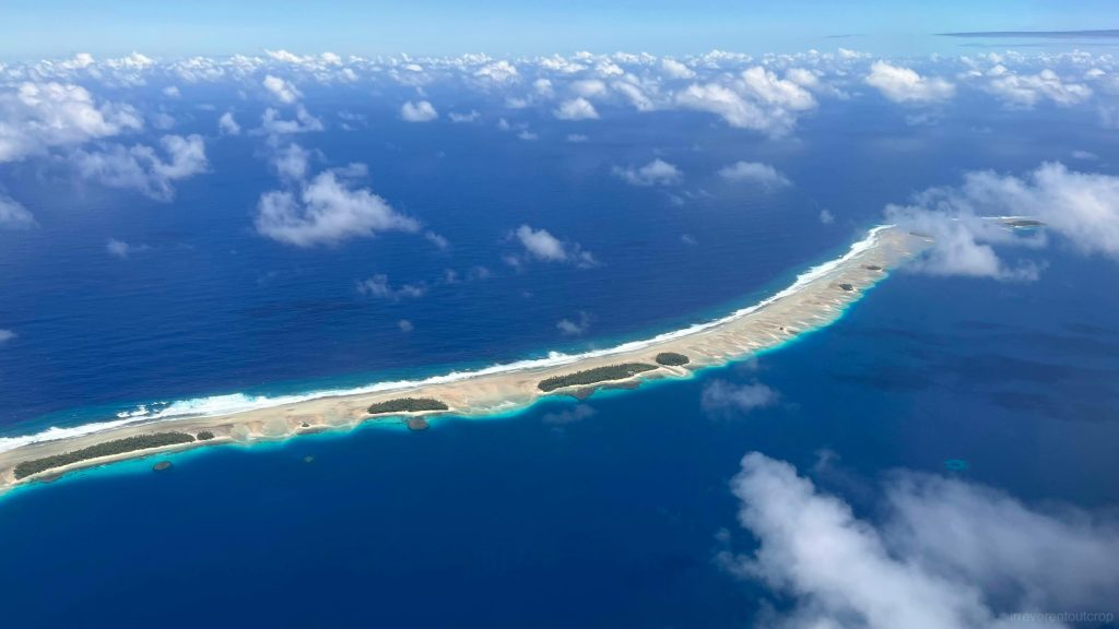
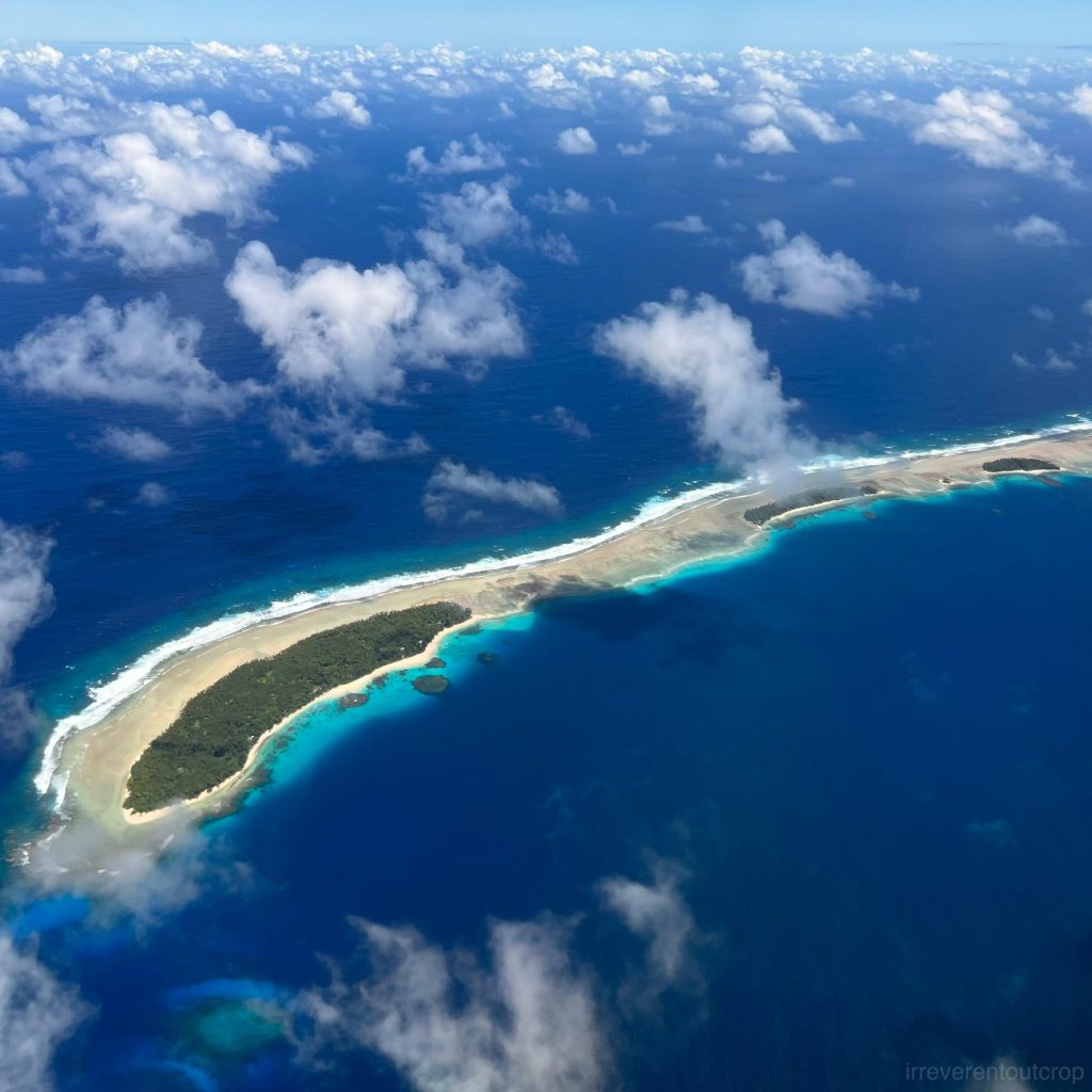
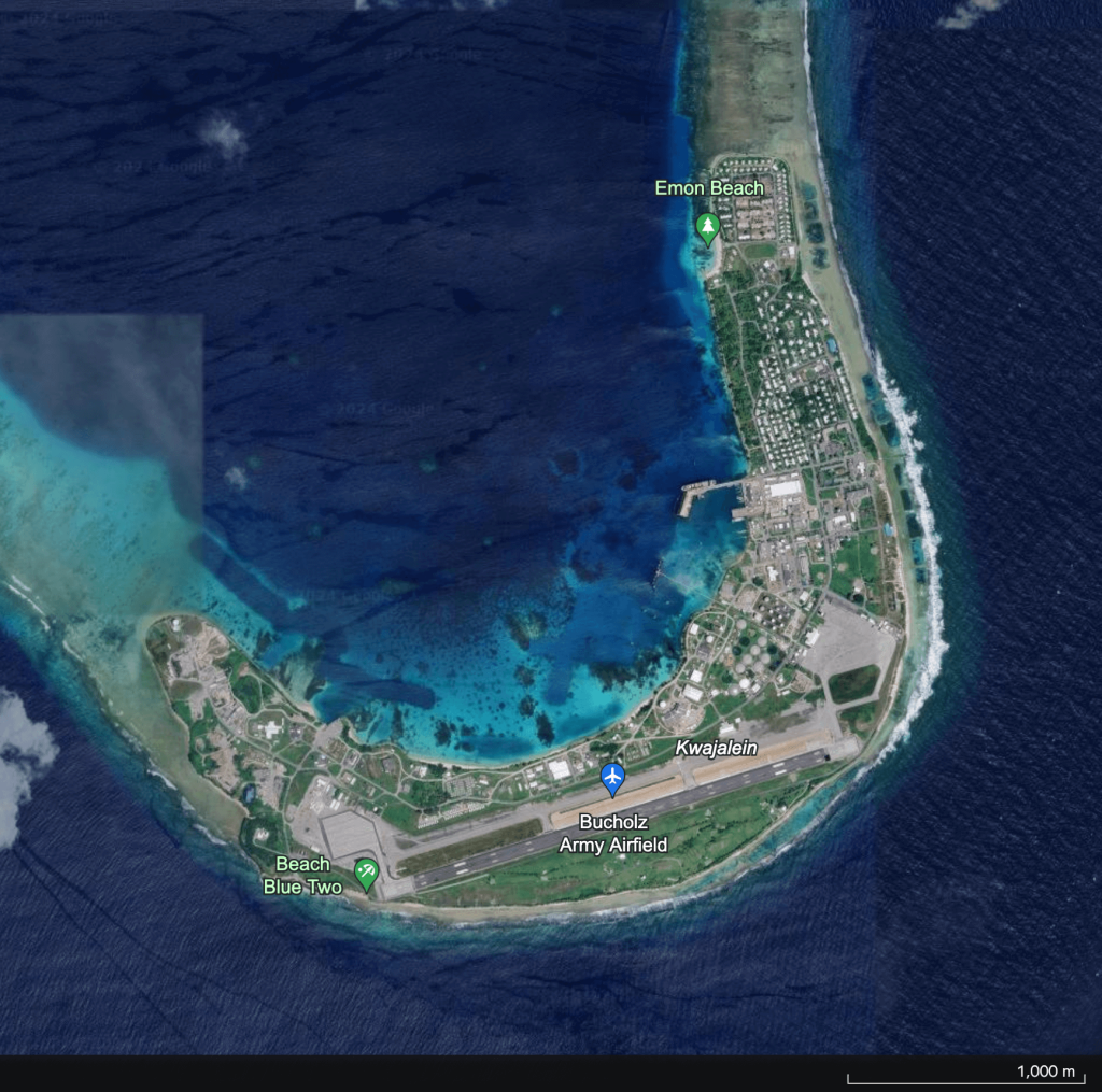
Kwajalein Atoll is larger than Majuro, but it has way more reef passes that cut the big “ring” into smaller and separated pieces. The slightly wider southeastern corner is occupied by a US missile testing base and is also where Kwajalein Airport is located. Besides American soldiers, many local Marshall Islanders disembark here, likely for work on the base. Many passengers boarding the plane here are US soldiers bound for Guam for duty rotation.
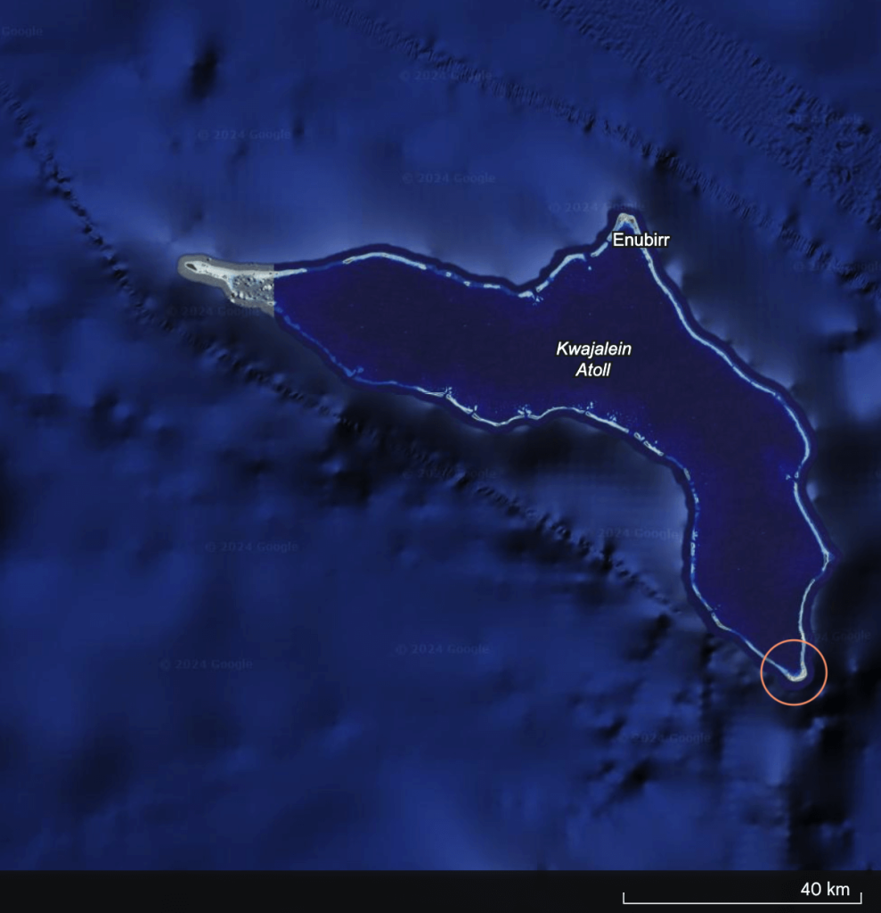
In addition to missile testing for the US military, Kwajalein Atoll also hosts one of the four ground antenna stations for the US Global Positioning System (GPS), the only one in the Pacific region. The other three antennas are located on Ascension Island (British Overseas Territory, Atlantic Ocean), Diego Garcia atoll (British Indian Ocean Territory, Indian Ocean), and Cape Canaveral in Florida.
During takeoff, landing, and taxiing, we saw military facilities surrounding the airport, including numerous polygonal domes buildings, and soldiers in uniform riding bicycles everywhere. However, due to the military nature of the facilities, taking photo is prohibited, and transit passengers are also restricted from disembarking. Google offers a a pretty clear satellite map of this area though:
Marshall Islands is quite unfortunate as a country: Bikini Atoll was used by the US military for nuclear testing; Enewetak Atoll was subjected to nuclear tests no less than Bikini and Runit Island of this atoll still houses a nuclear waste repository today left behind by the US military, with dangerous leaks that are left unaddressed; Kwajalein Atoll is occupied for missile testing as we could see from the plane. When it comes to compensation and aid, the amount is drastically insufficient- even the capital’s infrastructure looks poorly maintained, and I couldn’t imagine the conditions on other islands would get any better than that.
Not to mention that the whole country is made of barren low islands with extremely poor soil naturally. With the highest elevation point at only 10m / 33ft, they are at the forefront of climate refugee countries under the global environment of climate change.
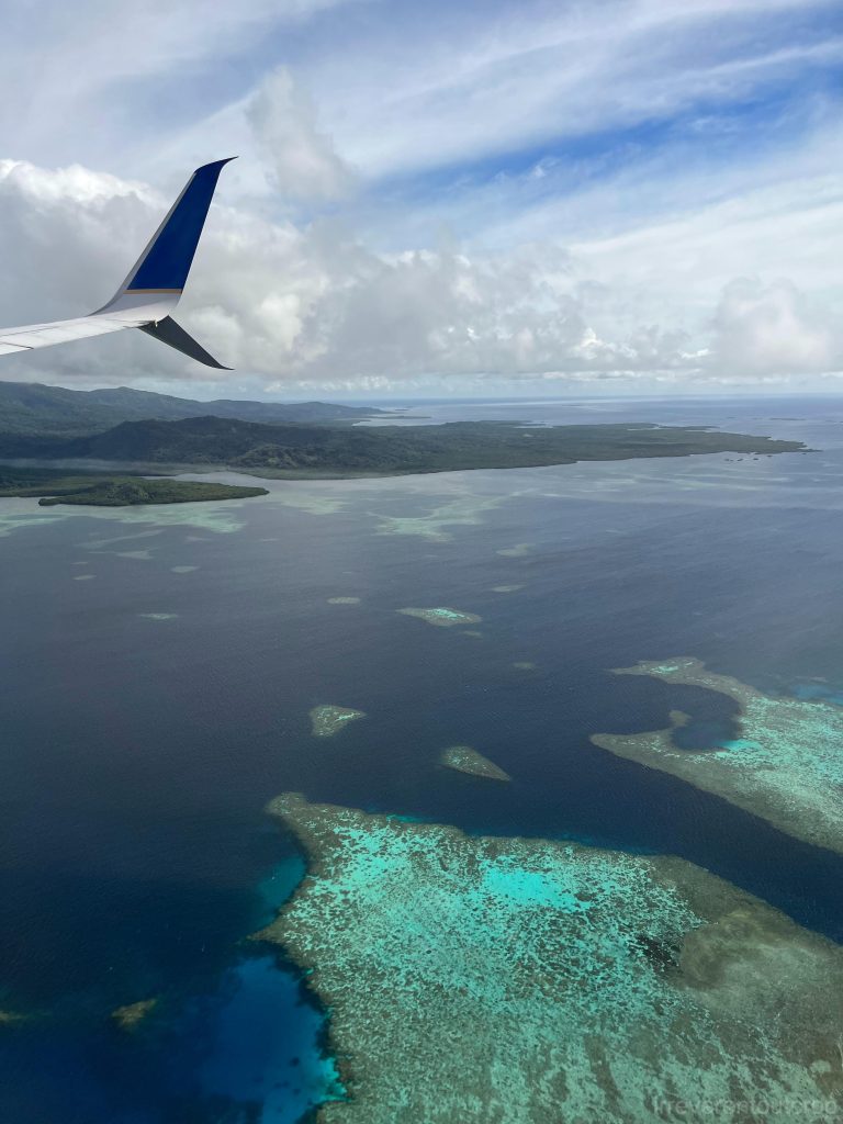
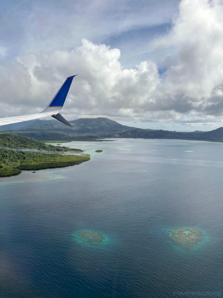
The Federated States of Micronesia
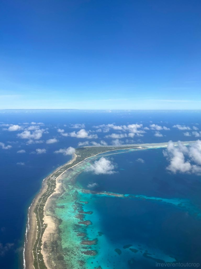
Kosrae Island’s coral reefs and mangroves
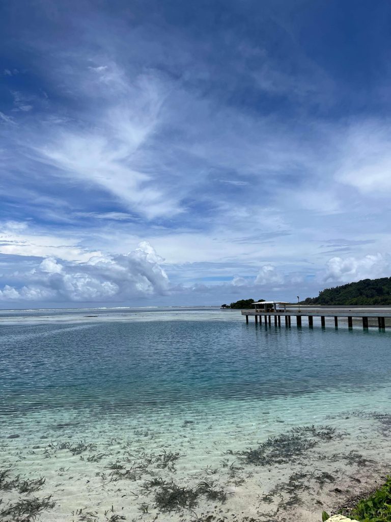
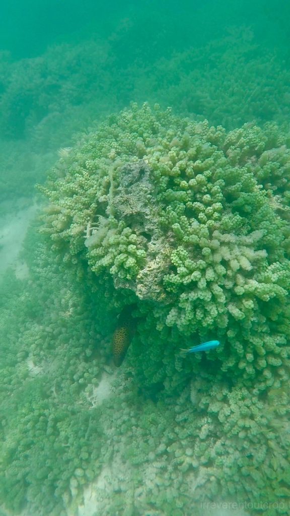
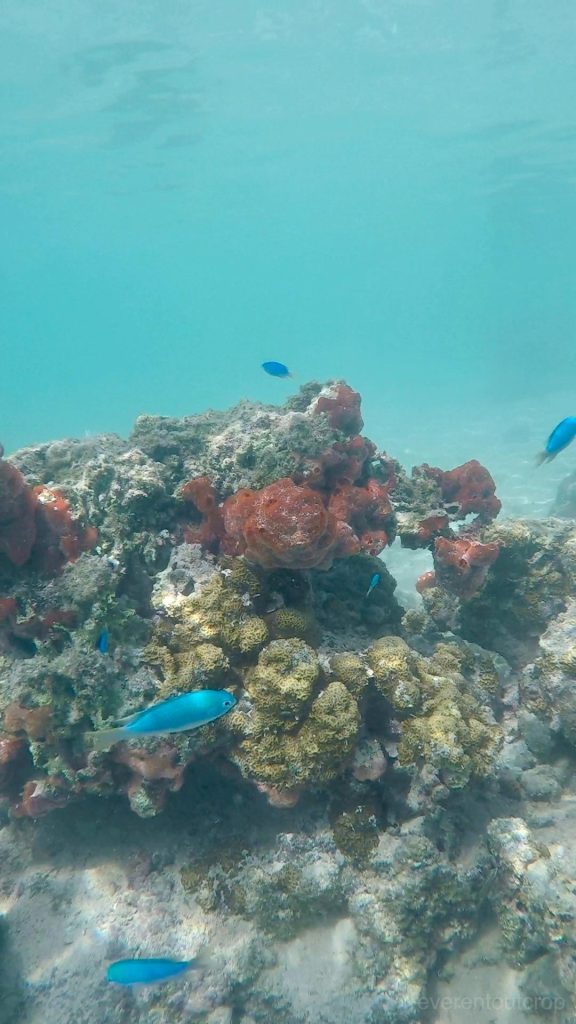
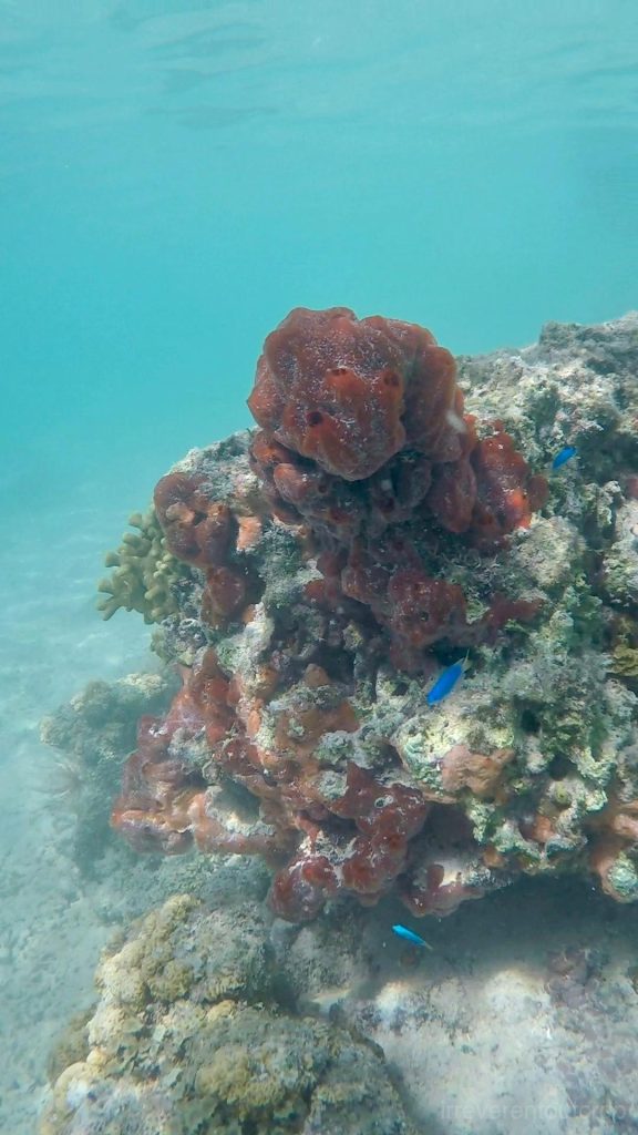
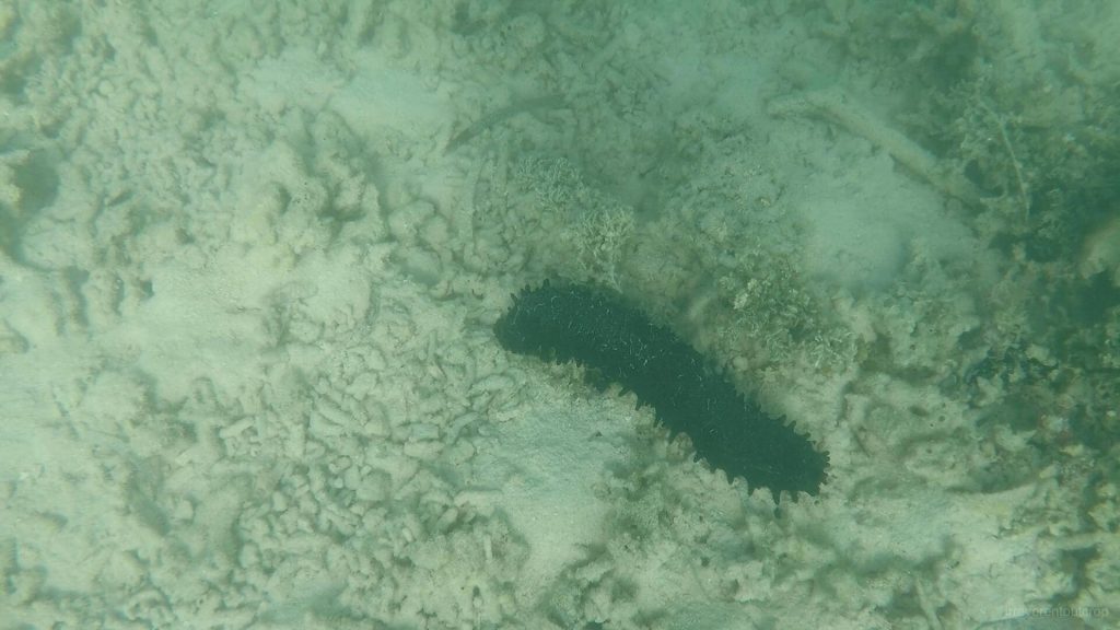
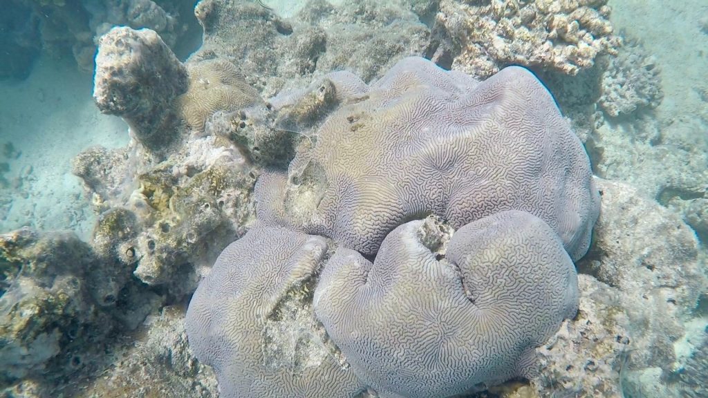
It was cloudy when we landed on Kosrae Island, so the colors of the fringing reef looked just alright from the plane. It wasn’t until the next day when it cleared up that we got to see its true colors while strolling along the coast. Tides significantly affect visibility of the coral reefs, usually best during low tide. we took a dive and saw giant sea cucumbers besides coral and tropical fish! We only visited the nearby blue hole since we didn’t have much time. Would definitely explore more snorkeling spots around the island if we visit again.
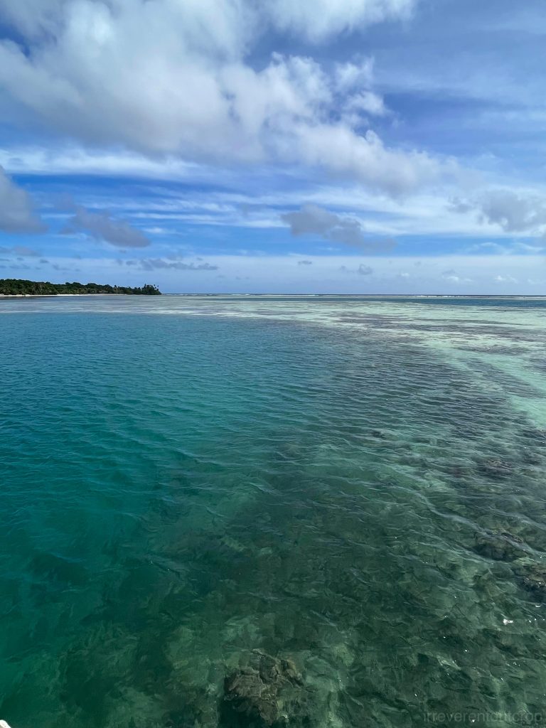
The coral is impressive! However, because the water is shallow with spiky corals and I’m not familiar with the area, I didn’t venture too far. There is no mark nor guides, so we are on our own.
https://irreverentoutcrop.com
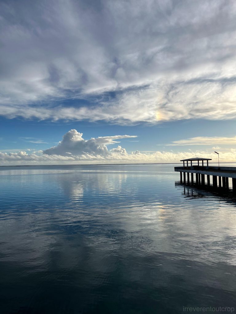
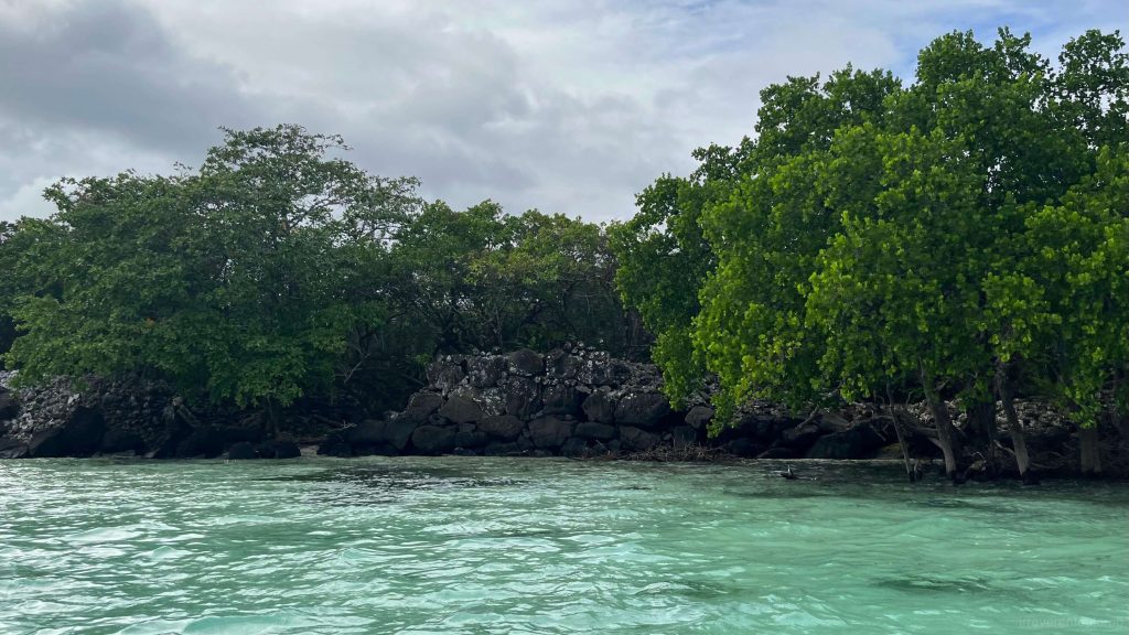
Tidal changes not only affect snorkeling situations in the blue hole but also significantly alter the landscape of the coastal mangrove areas.
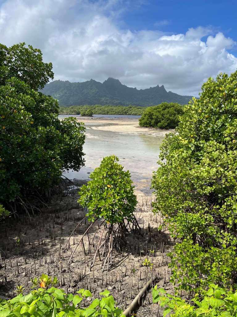
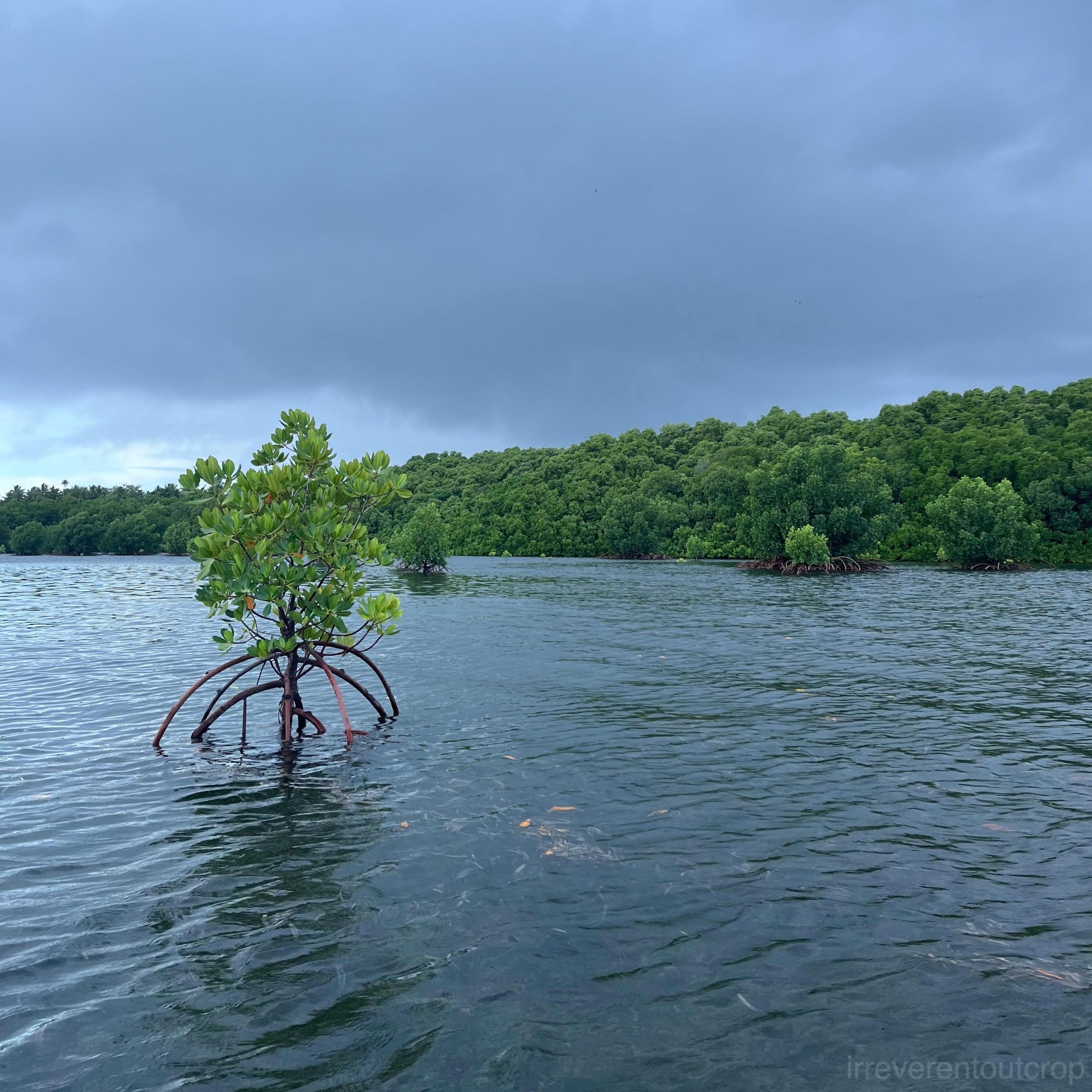
Kosrae’s mangroves are exceptionally well-preserved, dense and encircling the island. Mangroves play crucial roles in purifying seawater, providing protection against wind and waves, and contributing to the rich biodiversity along Kosrae’s coastline. On our final afternoon before leaving Kosrae, we decided to explore the mangroves by kayak despite the rain.
It turned out to be a delightful surprise and an unexpected highlight of our trip.
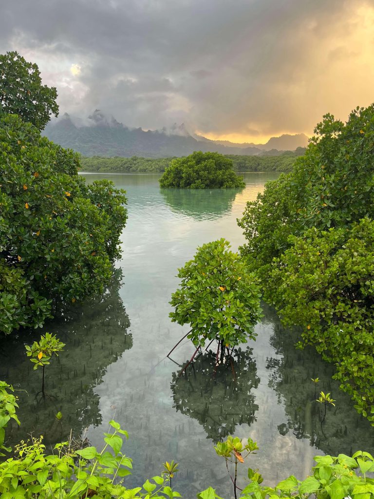
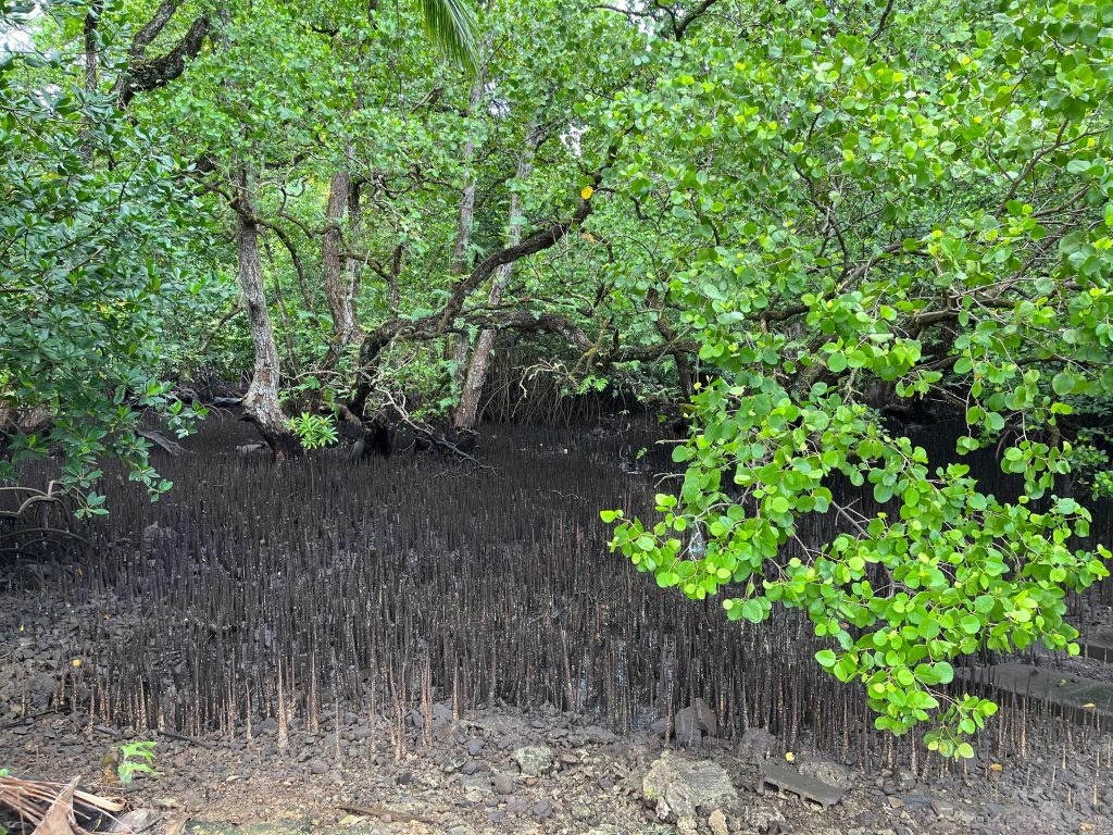
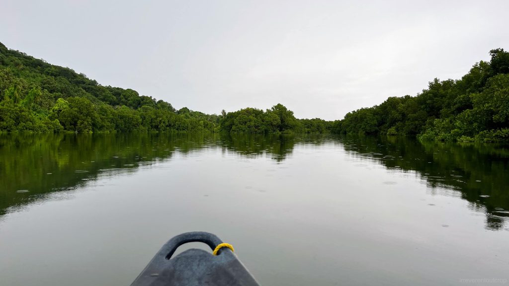
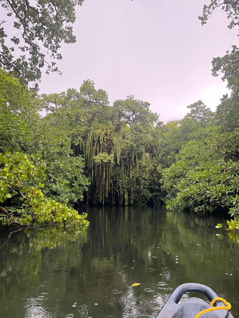
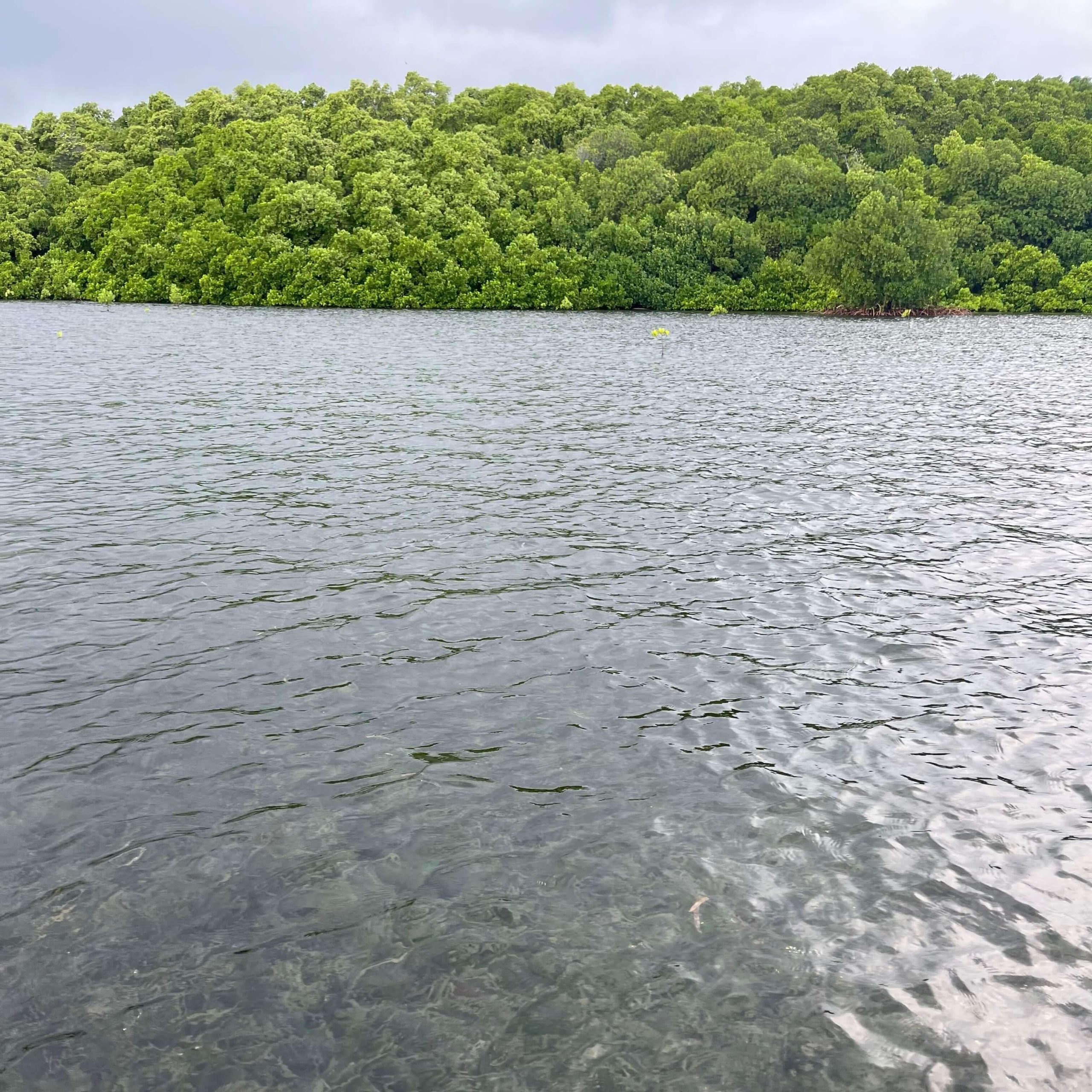
We rent a kayak from our hotel and launched it into the mangrove forest during high tide. At low tide, the mudflats were covered with mangrove roots, making it impossible to navigate into the mangroves. The entrance was narrow, with low-hanging mangrove branches overhead, creating an immediate sense of adventure.
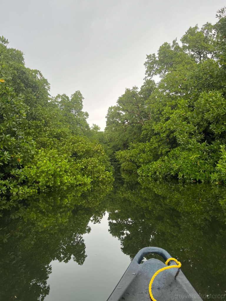
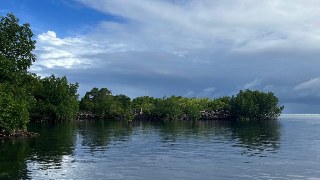
We paddled through a narrow and serene tributary for about five minutes, then suddenly emerged into the wide main channel, which was a refreshing change. This area is near the river’s mouth, where freshwater and saltwater mix together.
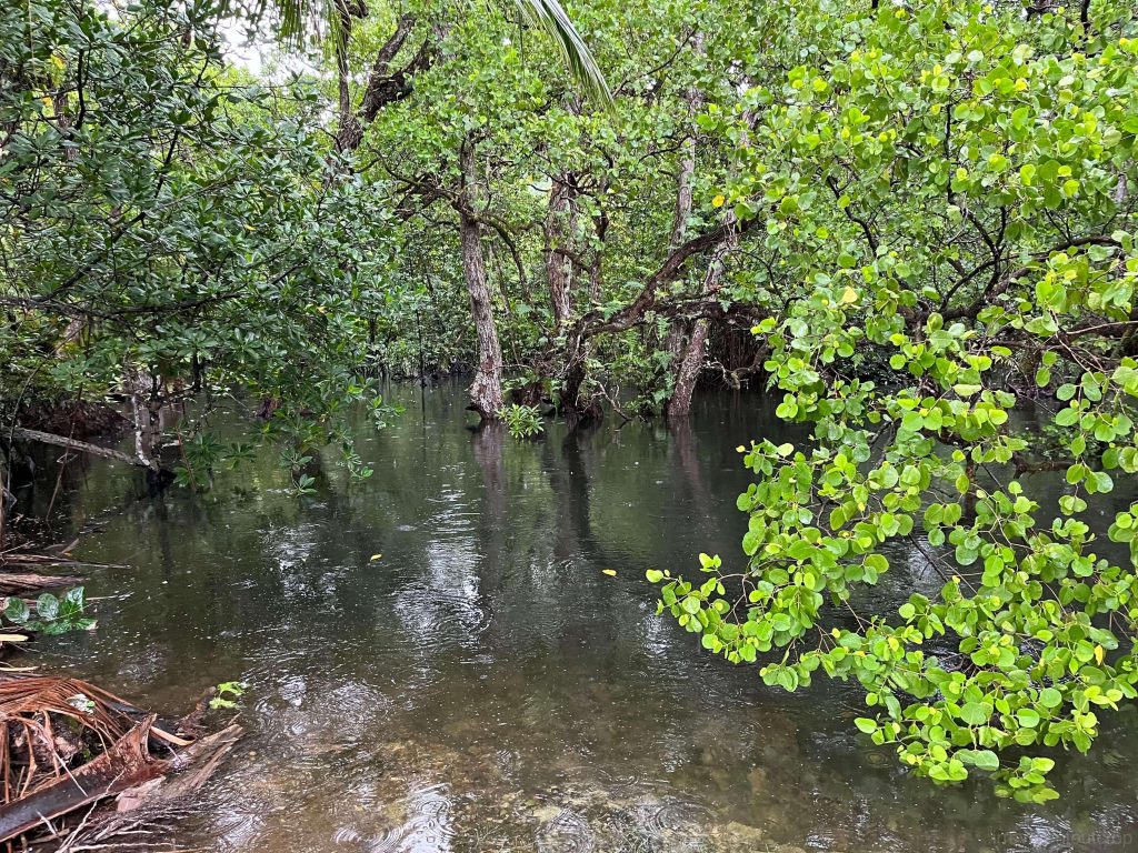
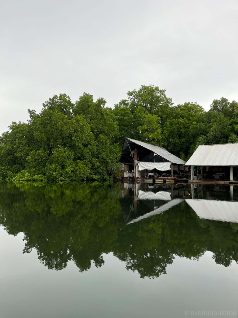
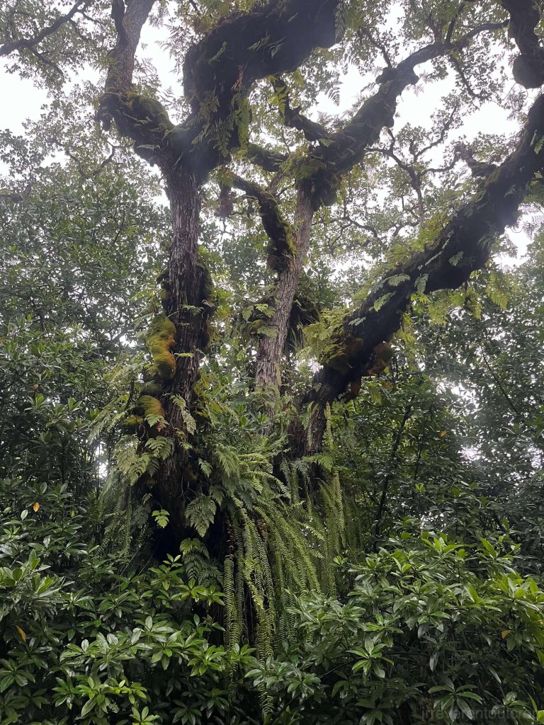
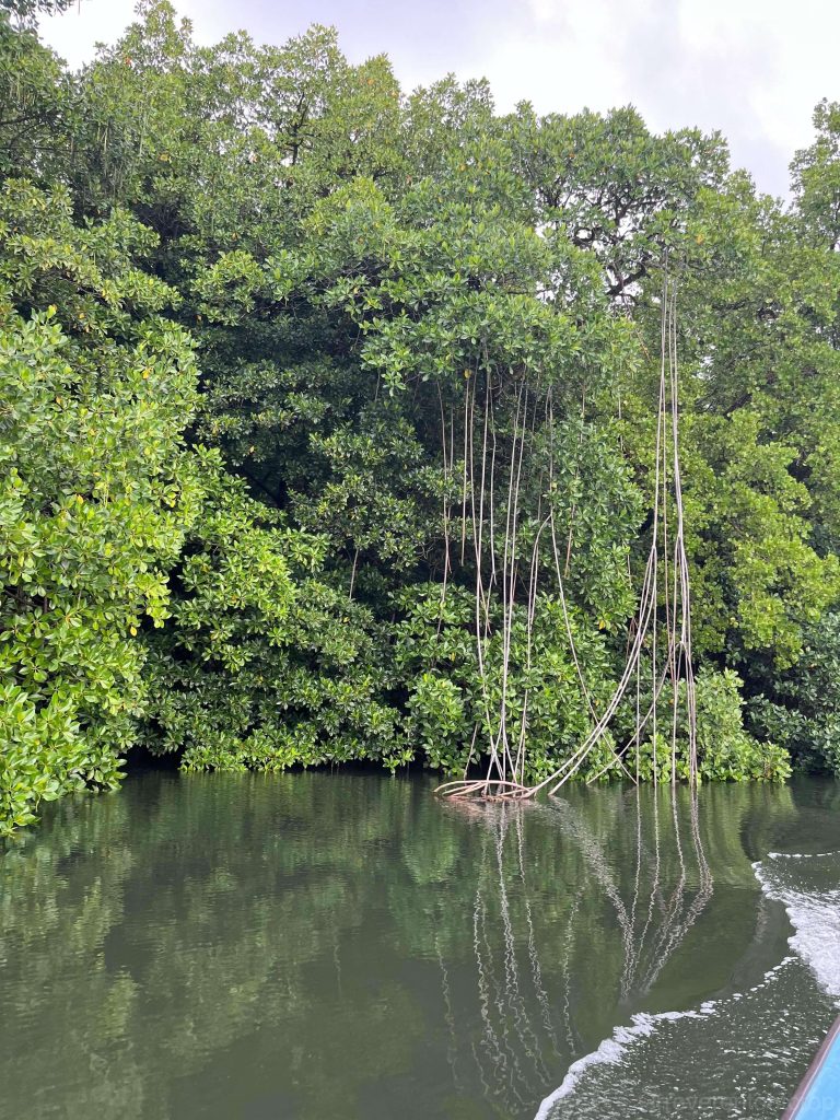
Accompanied by raindrops and seabirds, we paddled upstream. Passing by several local residences and small restaurants, the river gradually narrowed. We had to often duck under the mangrove aerial roots hanging overhead.
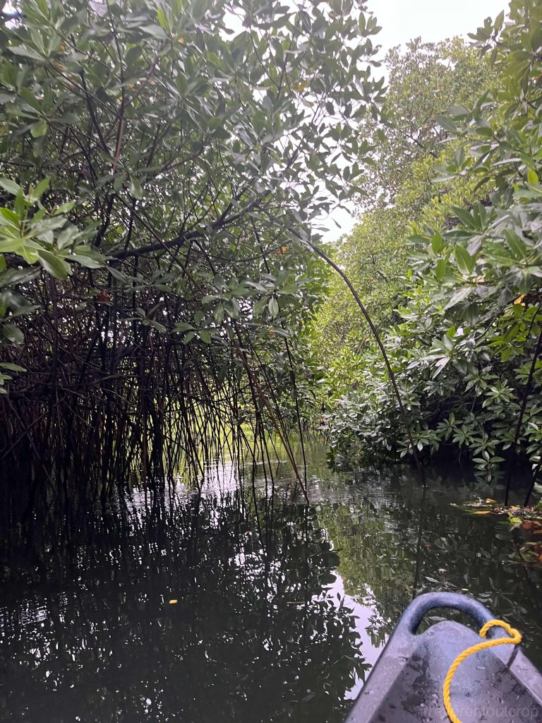
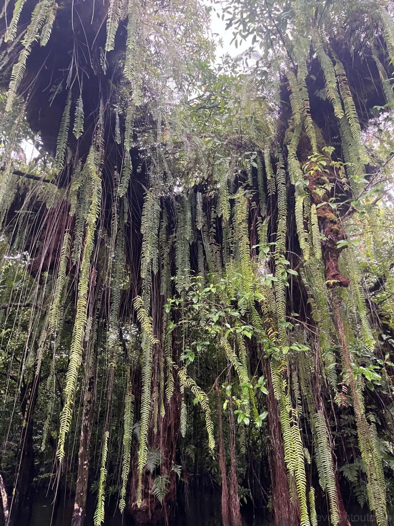
In the narrow upstream channel, we also encountered spectacular “fern waterfalls”. Large quantities of epiphytic ferns cascade down from the surfaces of trunks of large trees such as banyan and fig.
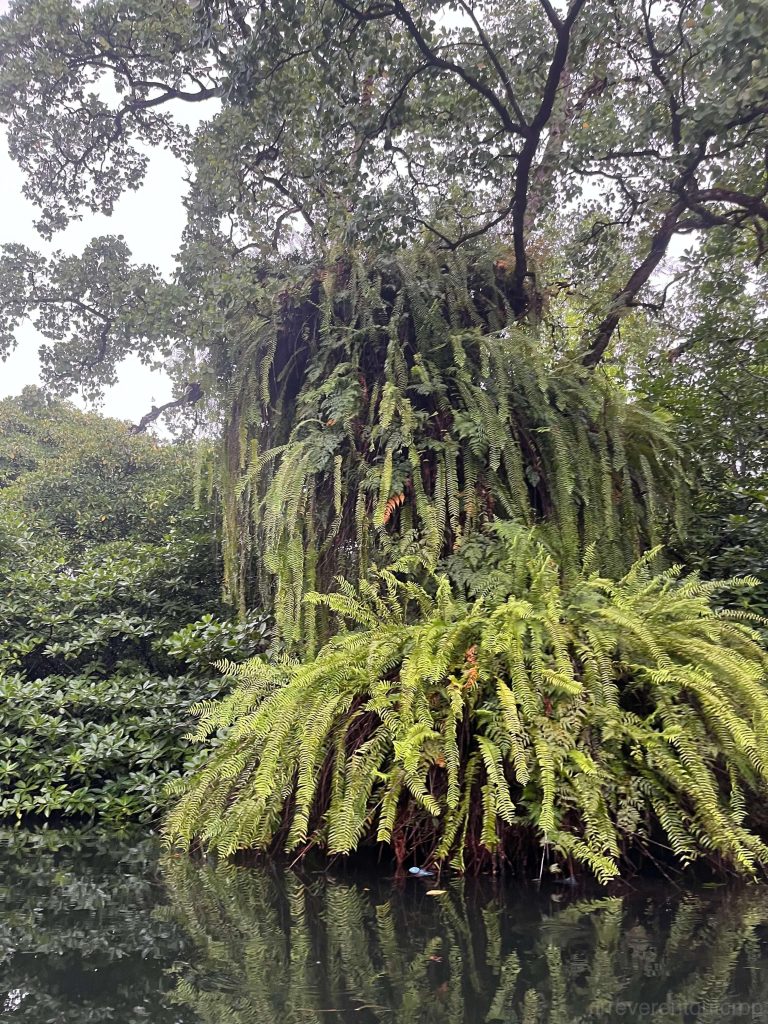
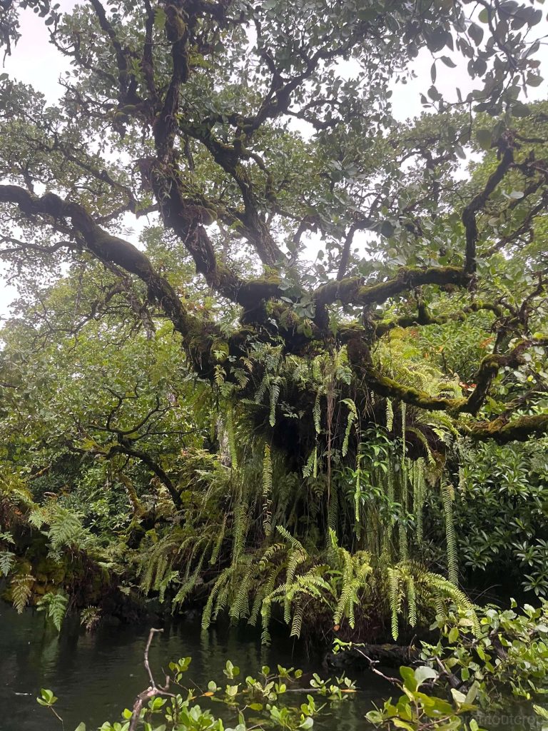
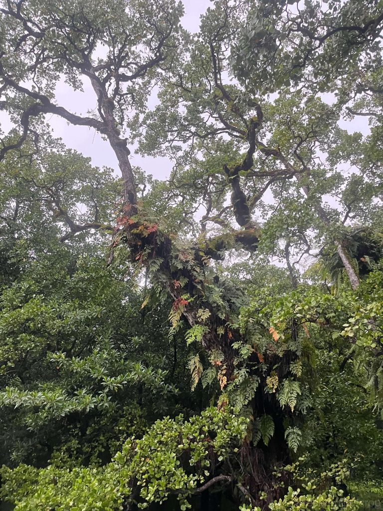
The hanging “waterfall” consists of not only epiphytic ferns, but also banyan trees’ aerial roots, roots of other epiphytic trees, and intertwining vines.
Pohnpei’s coral reefs and mangroves
Most of the activities during our stay in Pohnpei focused on visiting Nan Madol, hiking Sokehs Rock, and enjoying kava. We didn’t dive or swim. However, we did see Pohnpei’s impressive barrier reefs during takeoff and landing.
We first saw Pohnpei’s barrier reefs on the island’s eastern side.
The airport is located on the north side of the island. We had a clear view of both the barrier reefs and the fringing reefs before landing, as well as the lagoon between them.
We saw quite some mangroves on the way to Nan Madol, which is a mysterious ancient city characterized by its monumental megalithic basalt structures and intricate artificial tidal canal network.
The outer walls of Nan Madol ruins are also covered with mangroves.
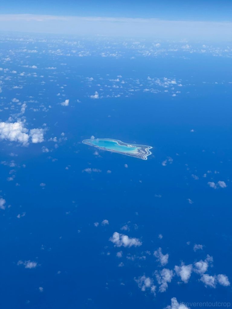
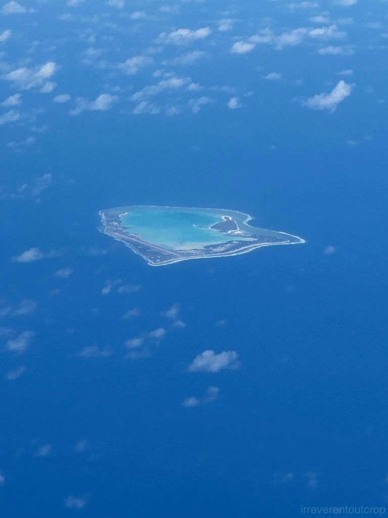
When we departed Pohnpei Island, we saw Pakin Atoll from seat F at the back of the plane during takeoff. It is a small atoll to the northwest of Pohnpei Island. The total land area above water of the atoll is about 1 km2 / 0.4mi2, with a lagoon area of approximately 14 km2 / 5.4 mi2.
Chuuk Islands
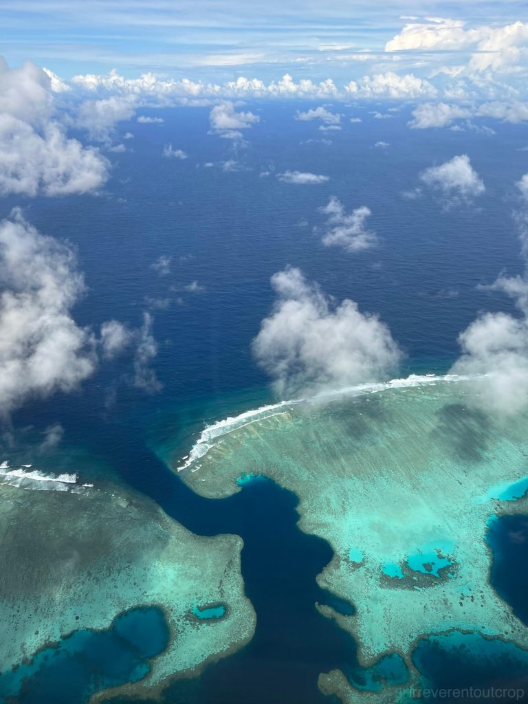
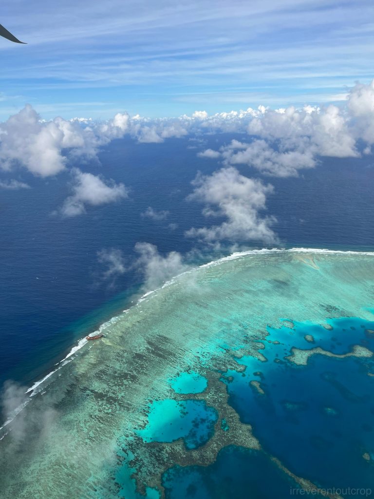
The barrier reefs of the Chuuk Islands are vast and stunning, stretching all the way to the horizon. Small coral islands scatter amidst the rugged volcanic main islands in the lagoon, creating a picturesque contrast.
It’s said that the coral reefs here is world-class, and diving can even reveal World War II aircraft wrecks.
The Chuuk Islands were one of the largest Japanese strongholds in the Pacific theater during World War II, , often referred to as the “Gibraltar of the Pacific.” This continued until Operation Hailstone in 1944, when Japan’s entire military base was bombed by the US forces. As a result, a total of 41 ships and 270 aircraft from the Japanese fleet are currently lying at the bottom of the lagoon, forming the world’s largest war ship and aircraft graveyard.

Sharks and manta rays of the Yap Island
Yap island’s airport only operates after midnight, so we don’t have a chance to see the fringing reefs around the island from the air. But we planned plenty of time for snorkeling during our stay.
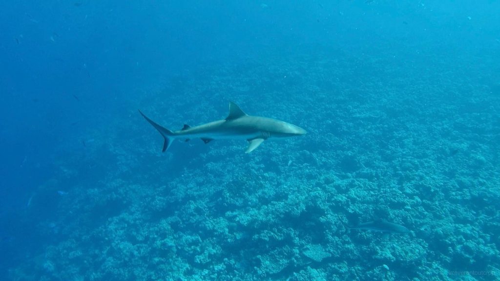
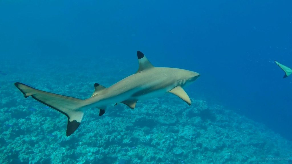
We went to see sharks first! The trip started from Colonia- the state’s capital town on the east side of the island- to the west side by car, and then we took a small boat to the outer reef through narrow reef passes. Here at the outer rim of the coral reef where the water is deep, we saw two types of sharks. One of them is the blacktip reef shark, distinguished by its black-tipped fins.
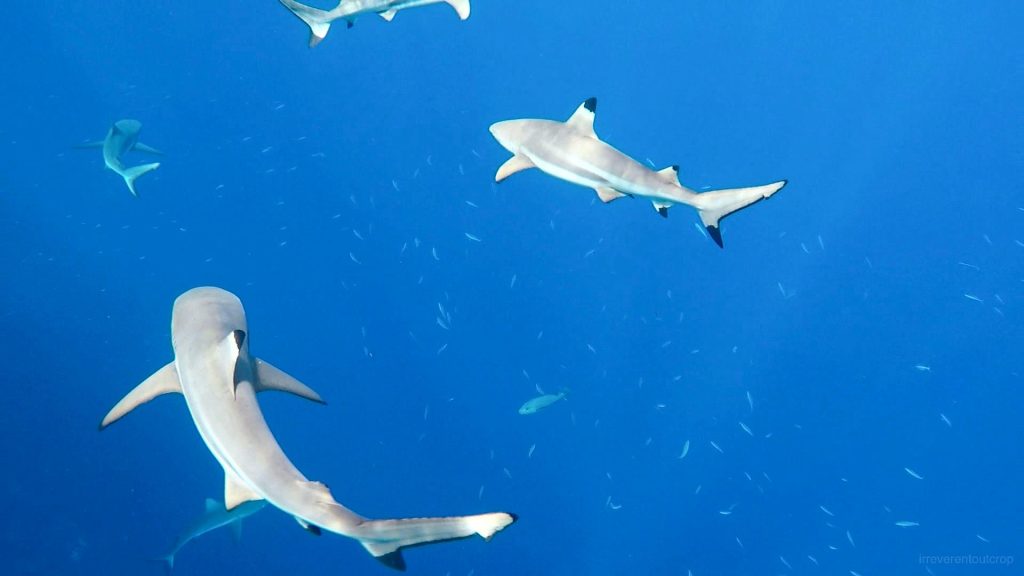
The other type we encountered was the grey reef shark, which appeared slightly larger and chunkier compared to the blacktip reef shark.
https://irreverentoutcrop.com
The dropoff outside the coral reef descends steeply into deep waters, making swimming very comfortable without the worry of hitting coral even with large flippers.

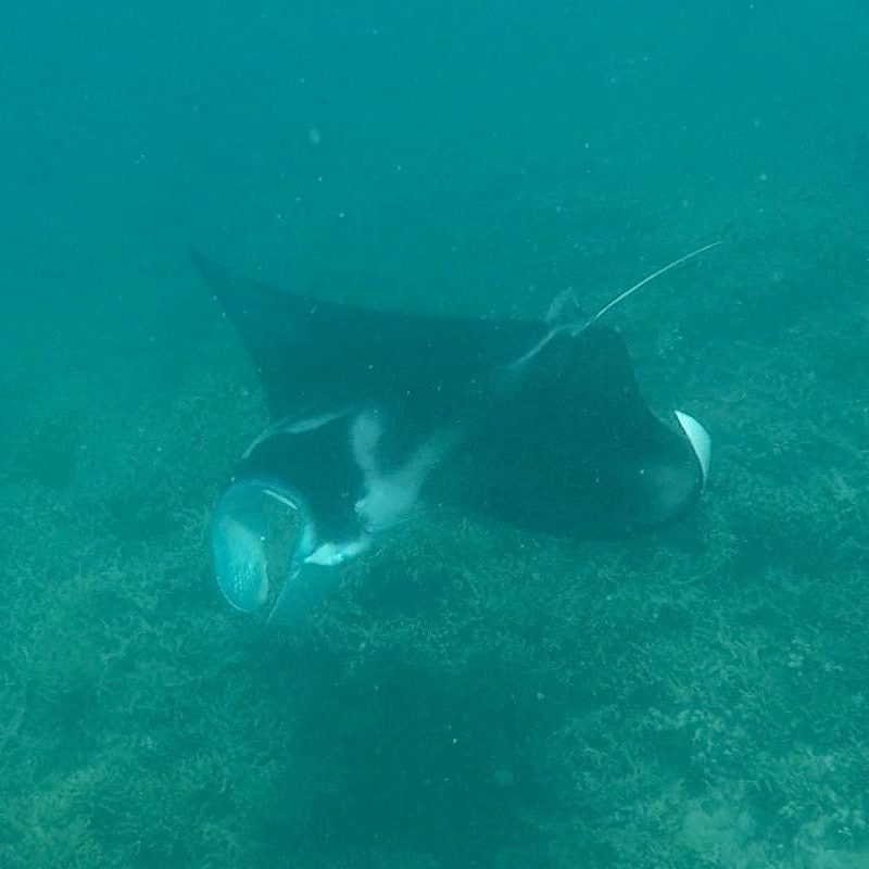
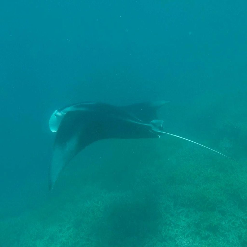
Later we moved back to a shallower area and luckily saw two manta rays! It’s widely believed that manta rays are among the most intelligent fish species and can pass the ‘mirror test’.
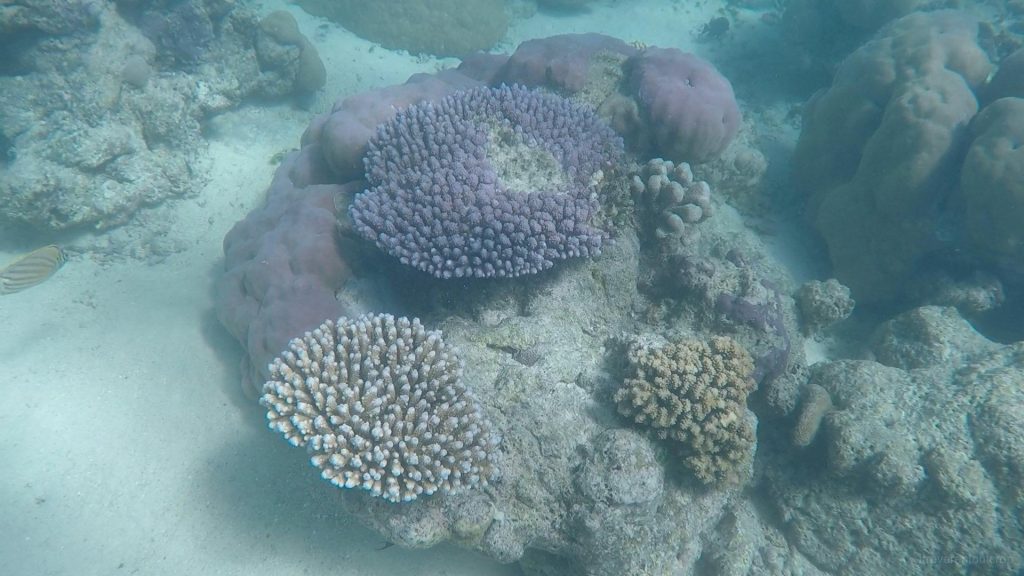
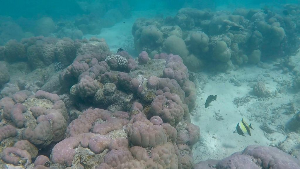
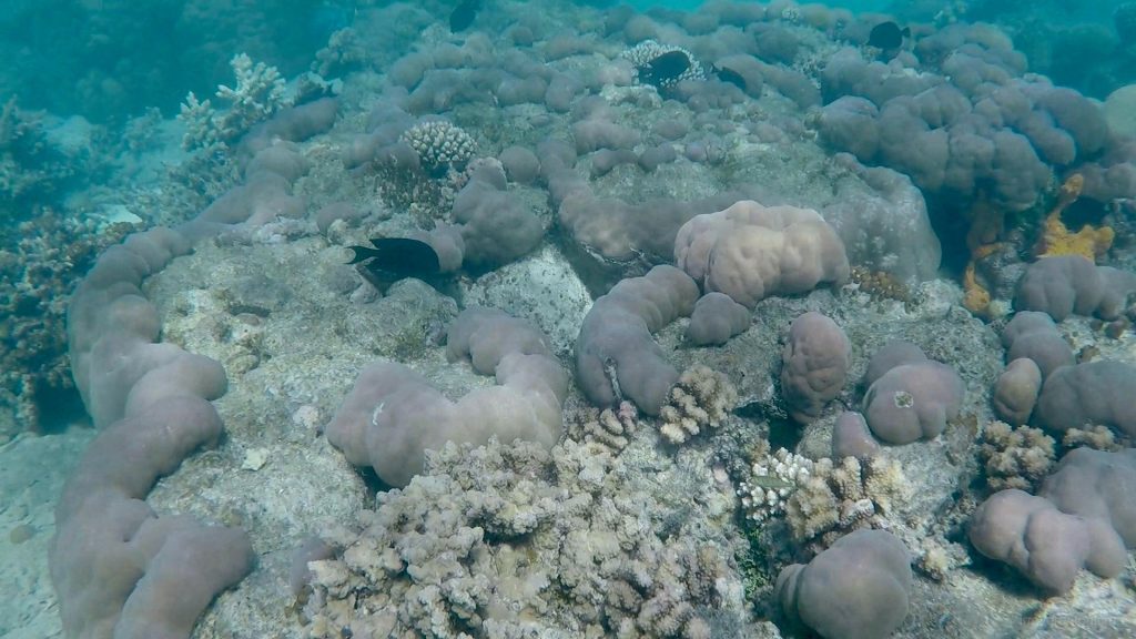
At the end we went to the area near the reef passes to snorkel and observe the beautiful corals.

After seeing sharks, manta rays and colorful coral reefs, our guide took us a different route by boat through a mangrove forest back to the starting point on Yap Island. The mangrove forest was quite lush but I was too tired at the time and didn’t manage to take any photos.
Others
Wake Atoll
Wake Island is a remote atoll hosting another US military base, located in the Pacific Ocean between Guam and Midway Island. Island hopper flights don’t fly close to it at all, and only non-stop flights between Guam and Honolulu would pass through. On our way back home, we took that non-stop flight to Honolulu from Guam, after a short hopping from Yap. We were exhausted on the plane at the time, but luckily the captain made an announcement in the middle of our sleep to remind everyone that Wake Island was on the left side. We woke up in time just to catch this nice view below:
The end
Thus concludes the Micronesia series! The previous post (part 1) covers volcanic landscapes, terrestrial vegetation, and megalithic remains of Micronesia. This post (part 2) focuses on coral reefs, mangroves, and marine life. Micronesia is hidden in a remote corner of the world. Apart from a few islands within the Marshall Islands used by the US military for nuclear weapons and missile testing, many landscapes of this region have seen minimal human disturbance. The travel experience is exceptionally rewarding.